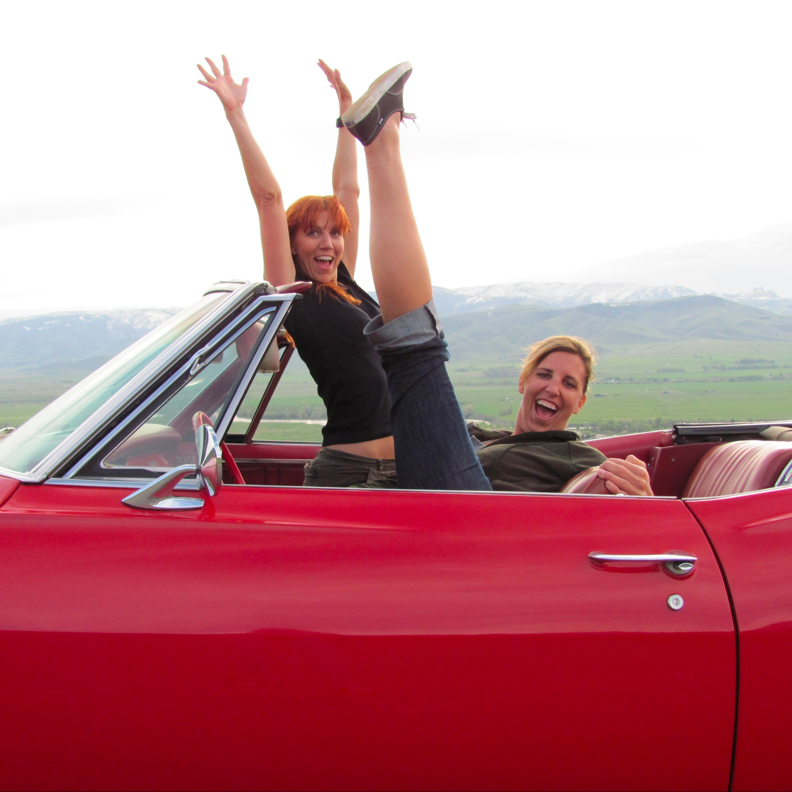

Recently, my boyfriend was able to take off a handful of days from work. We’ve been to so many places in California already that it is always a whole thing to find something new. I’ve been to Death Valley a few times. The first time was before social media blew up travel. My friend and I could drive anywhere and find a decent and inexpensive hotel with no problem. We even found an affordable room in Yosemite at the last minute. It definitely is more difficult to be spontaneous anymore, but with a little more planning than I like, last minute trips can still be done. The first time I went, my friend and I hiked in Mosaic Canyon. It was an easy hike. We had to get a bit above the canyon to see the winding part. We could have hiked longer, but the warning sign about sidewinder rattlesnakes kind of freaked us both out. Never thrilling to see a regular rattlesnake, but sidewinders just seem scarier and faster. That was long ago, when Dart and Map was still a baby.
Looking at the temperature in various areas within Death Valley, I thought my boyfriend and I were good for a few days.
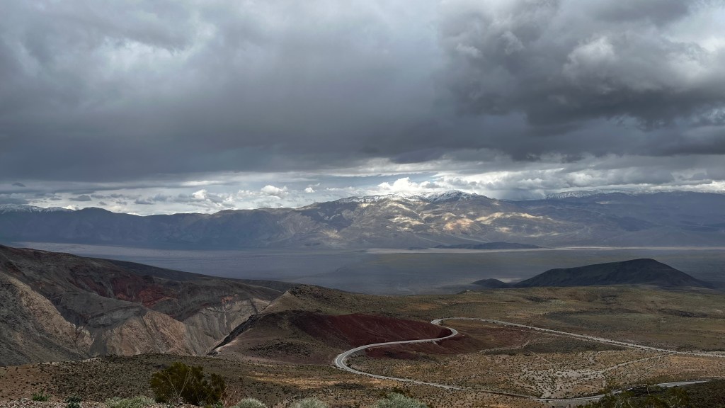
The only stop we made on the first day was Father Crowley Overlook. We drove from Los Angeles and didn’t have time to see too much during the day in the actual park. Since it was raining on the route we were taking, we wondered if we would be able to walk out to see the Rainbow Canyon or if it would be way too wet and muddy, but we had good fortune. The rain hadn’t gotten to it yet and we got to see a rainbow in the distance, which I then obsessed over long after we drove off. (It was visible for a while on the road.) It is a short walk to the vista area, the “end” of the cliff. It’s all very lovely the whole way, so at no point should you feel obliged to walk all the way if you don’t feel like it. Plenty of parking and a bathroom. (YES!)


That first night, we stayed in Beatty, Nevada. It was a cool little town and our hotel was great. My boyfriend and I are not meat eaters, and since we arrived rather late so our food choice was limited to a Denny’s in a casino. I was so hungry that I chowed down my veggie burger and don’t have a clue if tasted ok or not. With it being dark and neither of us feeling like gambling, we turned in for the day at our Motel 6.
The next morning, we skipped the Ubehebe Crater and Racetrack Playa because it apparently takes a long time to get to both of them. It also sounds like a quite a bit of off-roading to get to the Racetrack. We were not prepared for it with emergency gear, like a jack for the spare tire, so opted out for safety.
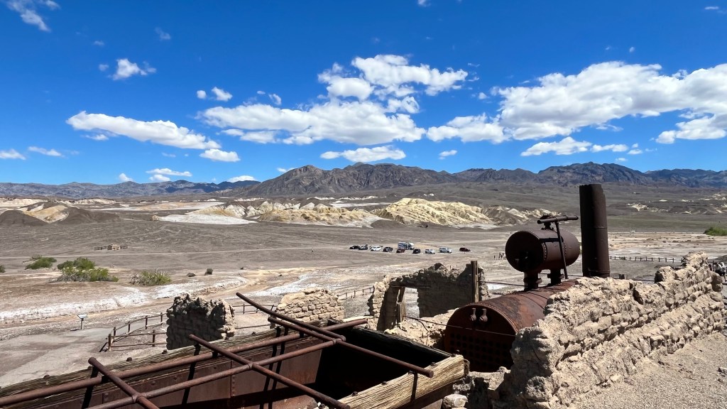
We had some hikes in mind, but ended up seeing a bunch of main attraction/easy access tourist sites that are all near each other instead. Well worth it because everything is stunning. Also, the temperature was way hotter than my phone app claimed it would be, so it was what it was. We started at Harmony Borax Works. I don’t use borax for laundry but kind of want to get some because it’s so old timey. Anyway, there is a parking lot and then a paved path to the attractions. The path is a very easy and short walk, and has some equipment that was used with explanatory signs about it and about the Pacific Coast Borax Company 20 mules mining days.
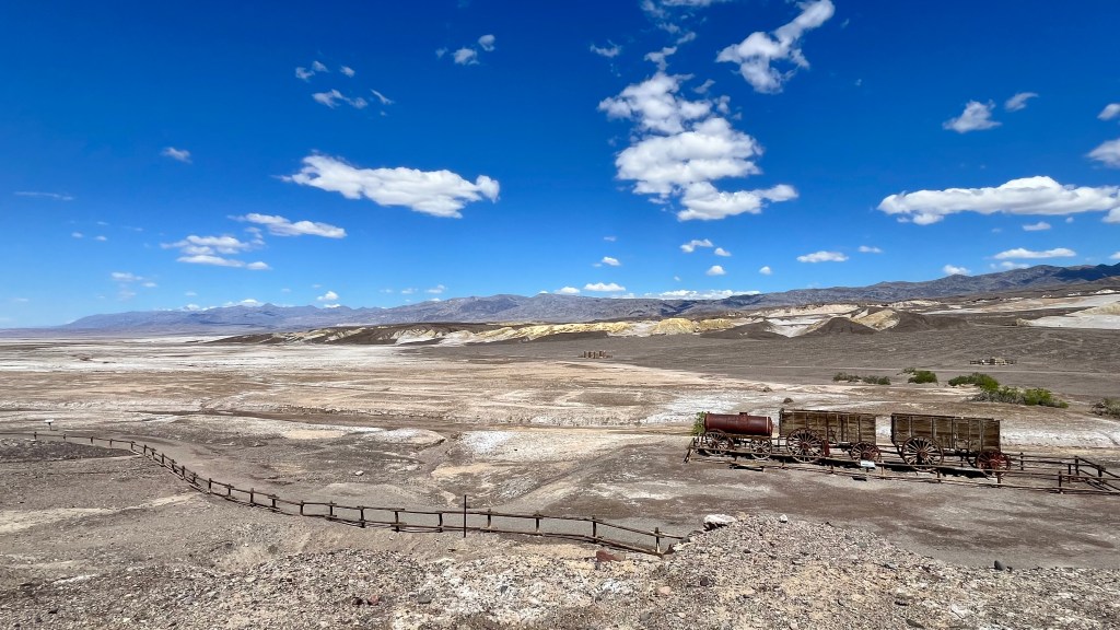
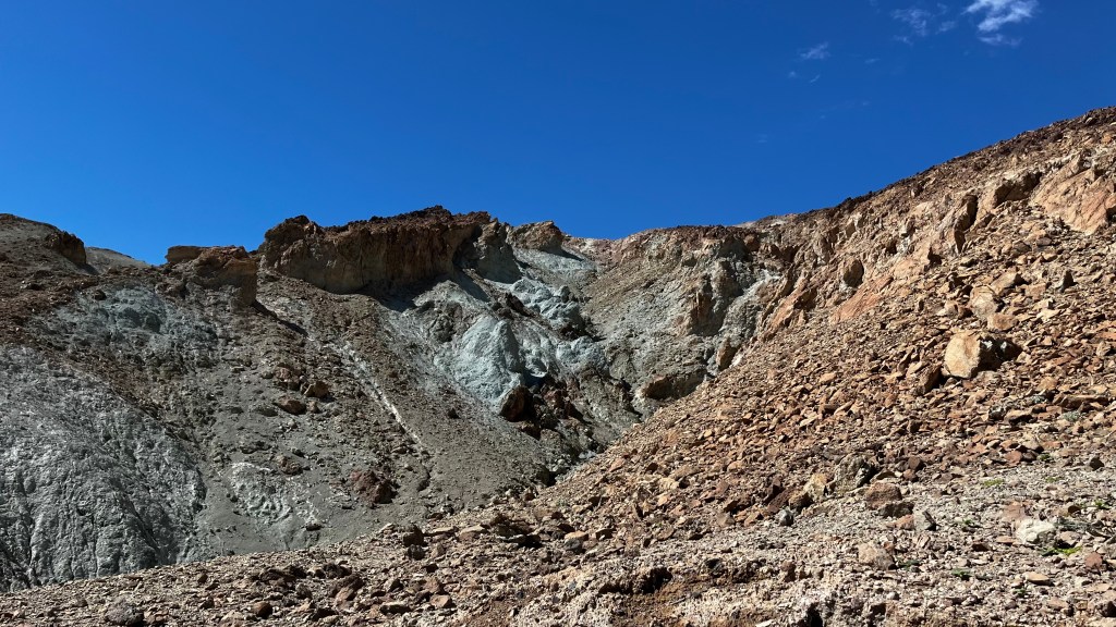
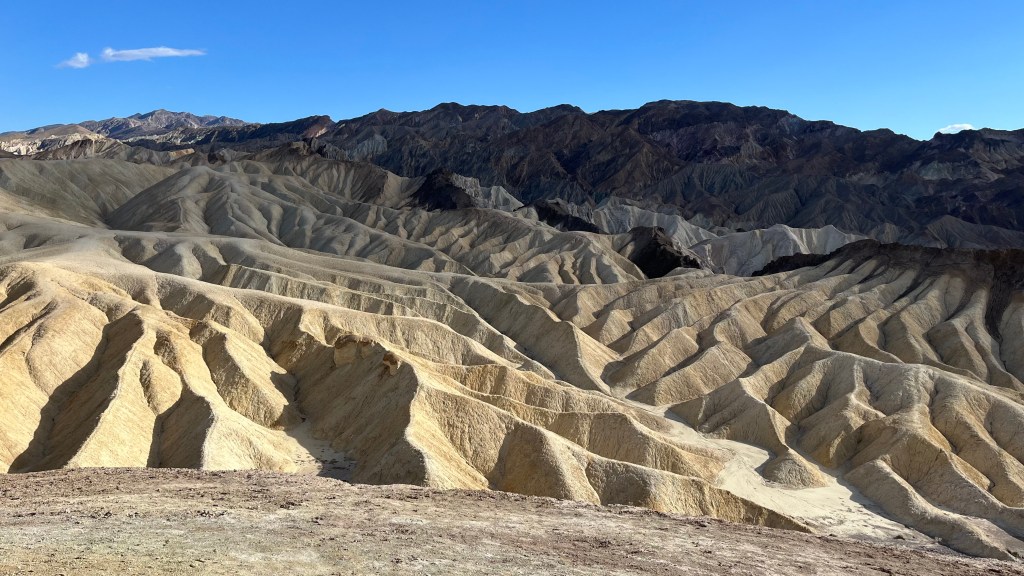
The surrounding views are rock formations with green/yellow/pink hues and the salty basin.
Made a quick stop at the Visitor Center in Furnace Creek to buy our yearly Parks Pass. They have bathrooms there and food nearby. It was very crowded. I suppose everyone wanted to get that last trip in before DV goes into the 100+ degree summer.
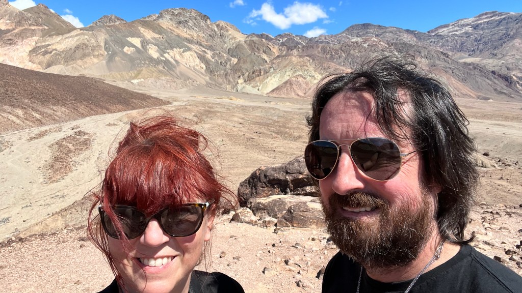
I had planned on doing the hike in Golden Canyon, but it was in the mid to upper 80s, significantly hotter than I expected and since I am now a big baby about heat, we drove past it and went to Artists Palette. We got out of the car to check out a stunning view. There was a small parking area near a hill we decided to check out. The climb was pretty easy, and despite the crowd, was still quite pleasant. The hills are alive with colors and Artists Palette is a very appropriate name.

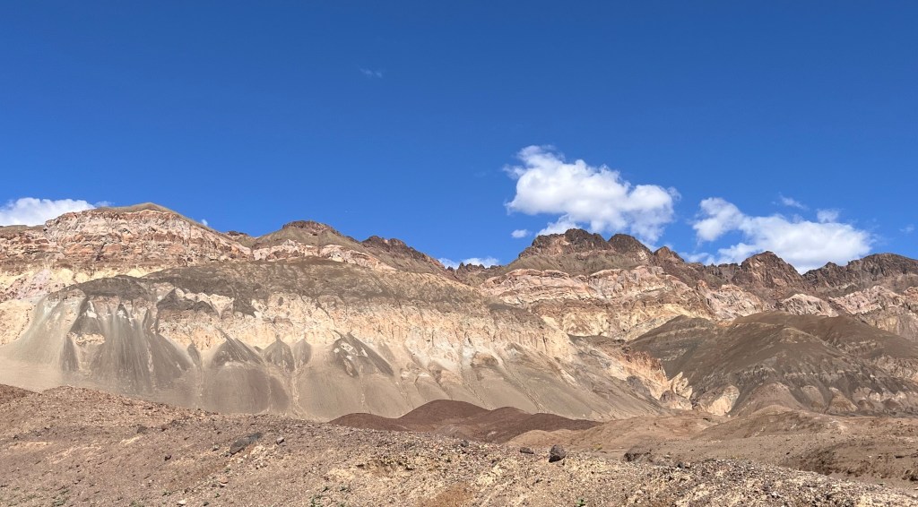
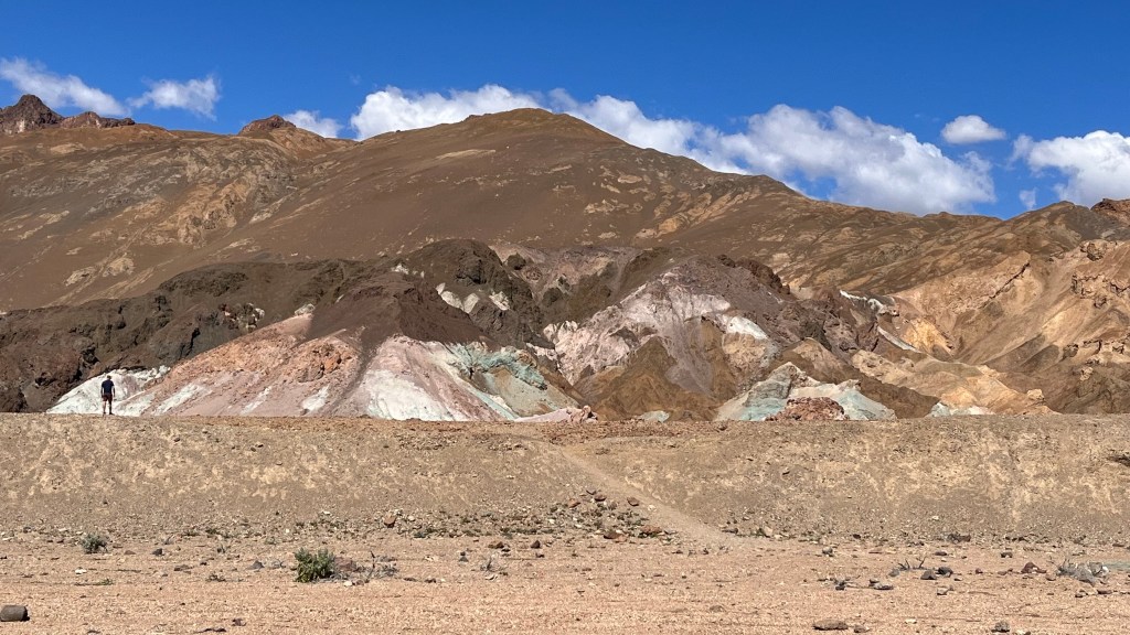
My pictures do not do it justice at all. Breathtaking!
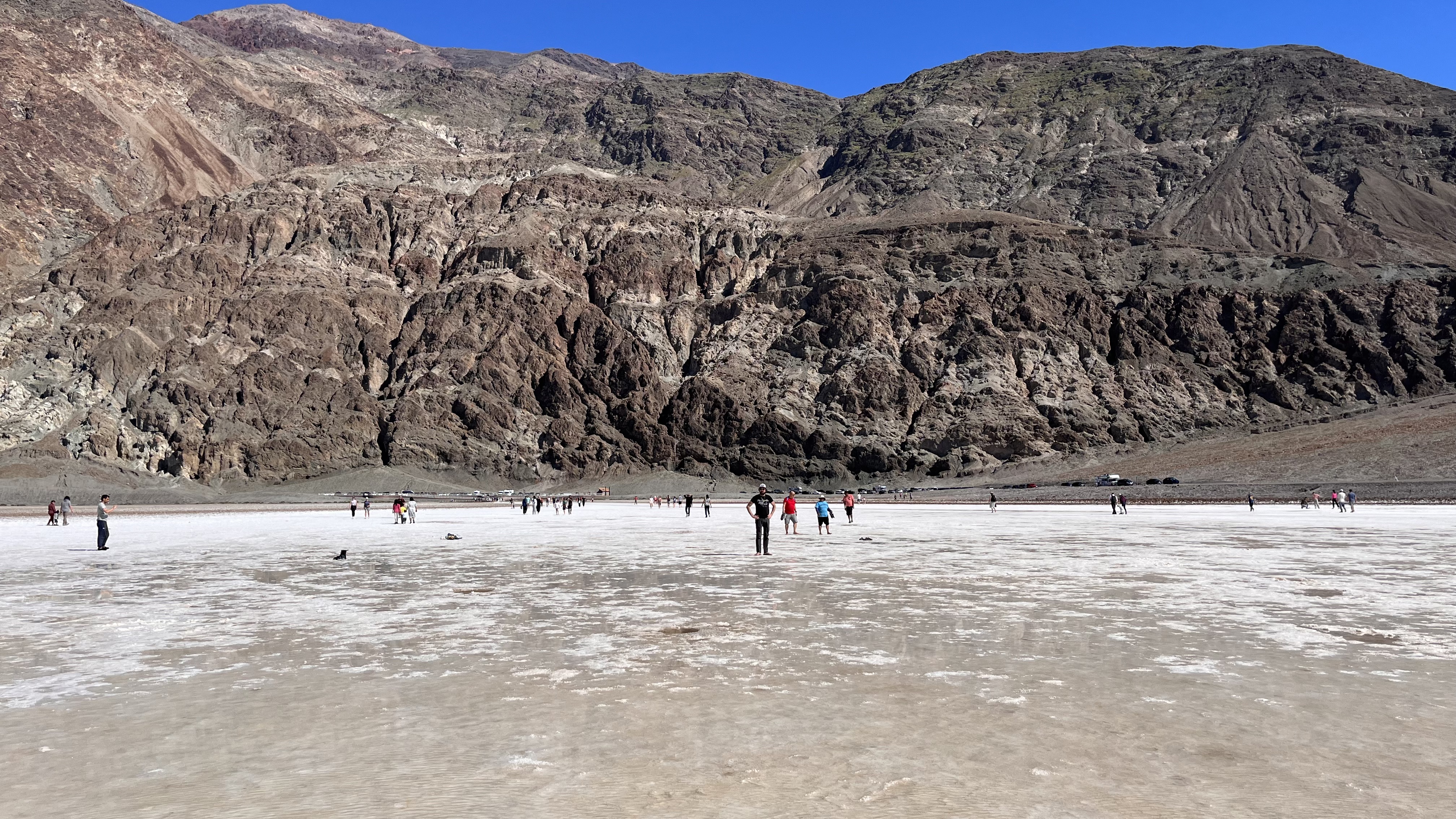
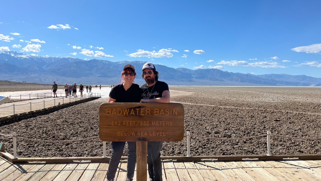
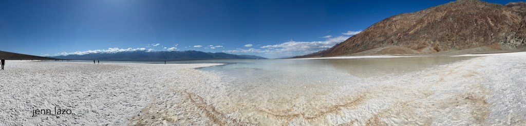
Onwards to Badwater Basin. I had wanted to see it for so long and it was as amazing as I had hoped! It was very crowded, but we found parking off the road nearby. Most of the people went straight ahead from the boardwalk into the water, but we went to the right and it was mostly empty. I cannot recommend this stop enough. Boy was that neat. I walked into the water as far as I could. I didn’t have another pair of pants so was leary of getting salt all over them. My Tevas still have some salt on them. Badwater is the lowest point in North America! It was so clear and stunning. I mean, you see the pictures in magazines and online, but they still don’t prepare you for how freaking cool it is.

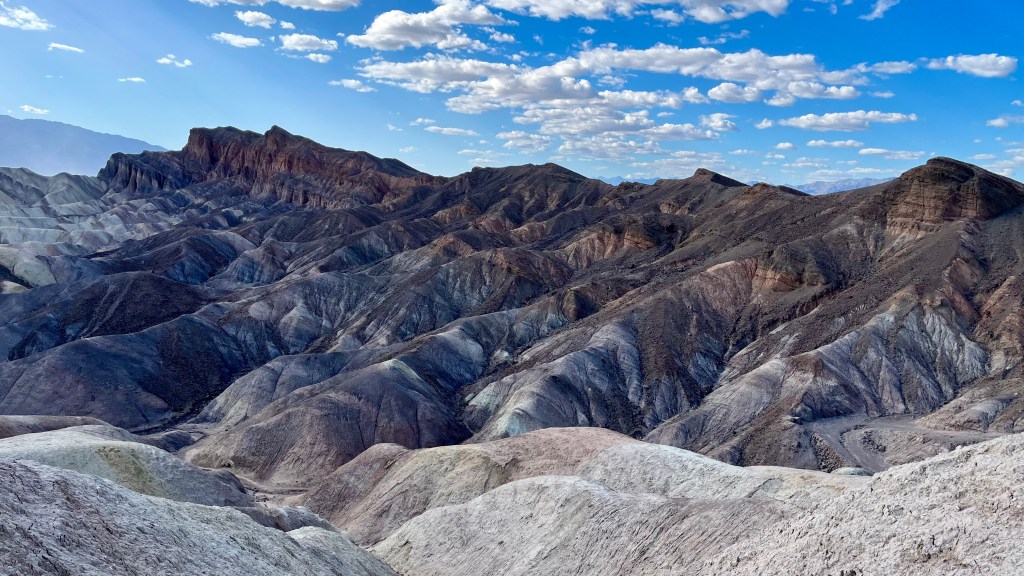
Next up: Zabriskie Point. Another easy to park – easy-to- walk-to vista point. You can go on a hike starting here or just be lazy & look out from the viewing area like we did. Good god! How is this even real?
We just had to fit one more site in before we headed to our next hotel. We finished the day with Dante’s View. Up, Up, Up you drive. There was ample parking and very worth the extra time we took. What a view of the valley below! And sooo windy!!

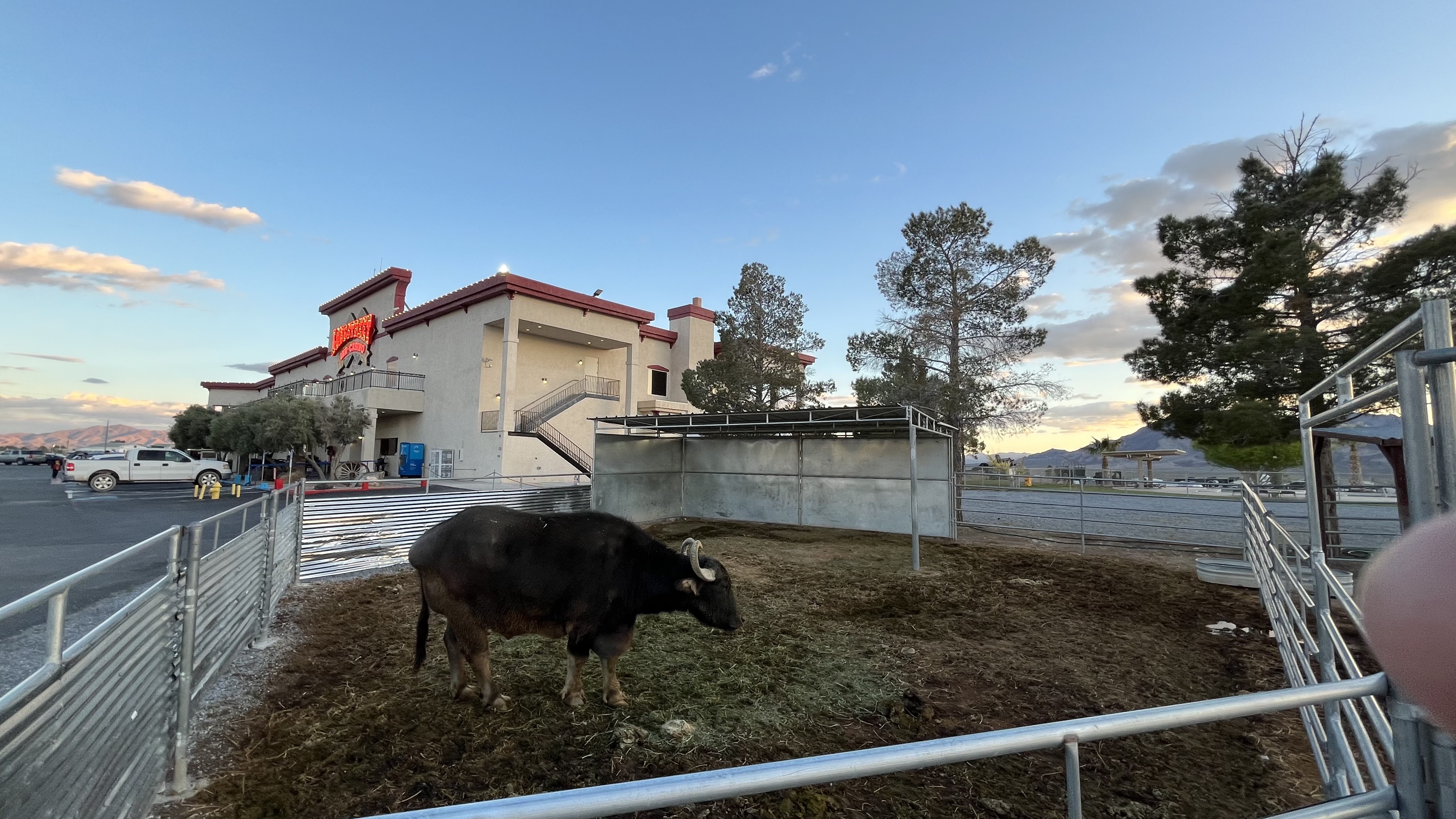
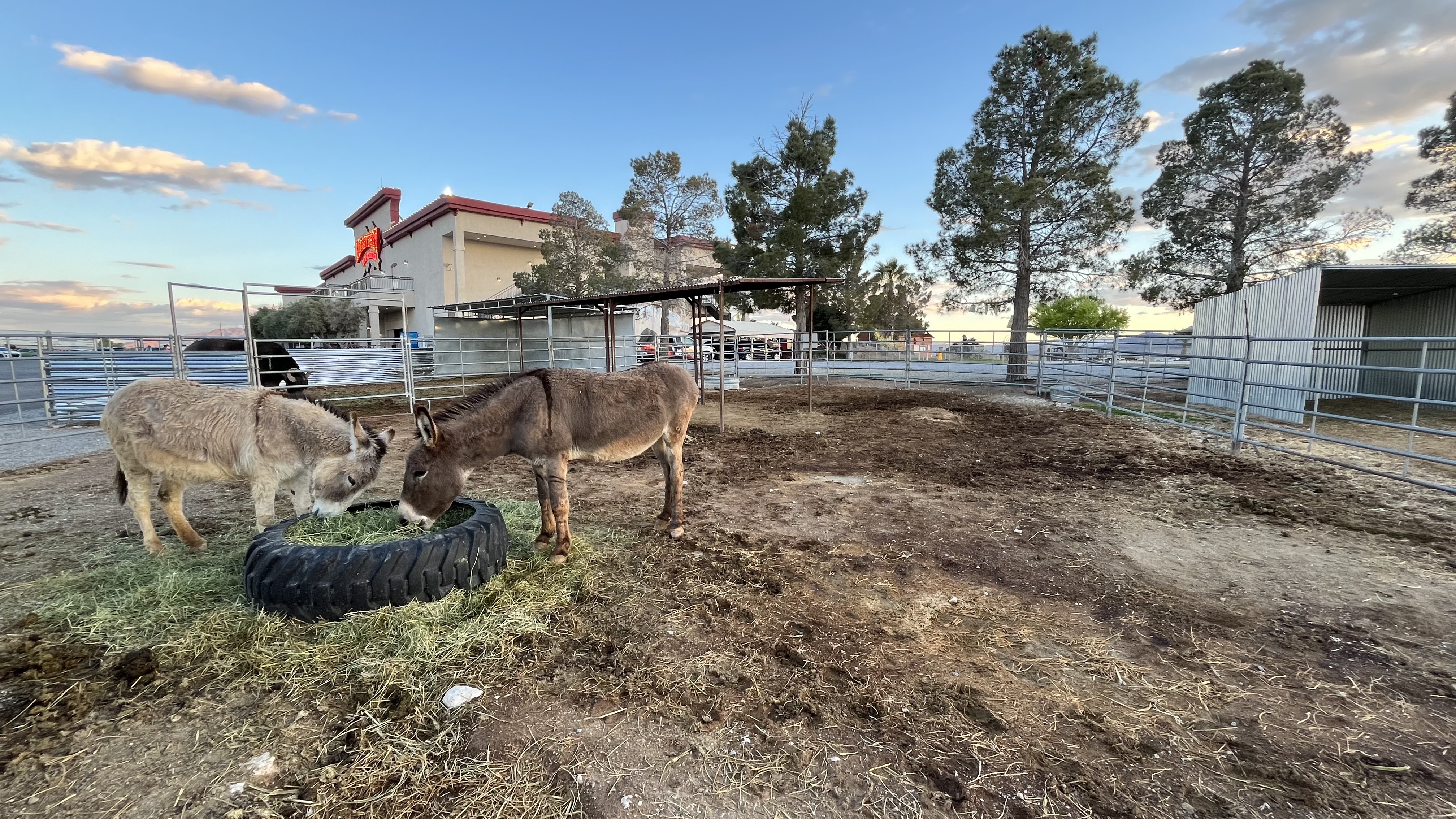
We stayed for a while, then wondered what food options might be available for dinner. Luckily, we were able to get take out food from the restaurant in our hotel, which is also a casino, and settled into our room for the night with some wine while watching true crime shows.
Oh, and our hotel had animals. I do not know if the animals always stay in the small areas or have a larger home and are perhaps traded out every so often.


You can download the National Park Service app, making it easier to research your destination. Death Valley National Park has a few audio self- tours you can listen to, and Star Wars filming sites is one of them for all of you nerds.
Whenever I go to a park, I take photos of anything they have posted on their information boards, including what roads are open/closed, if there are any other dangers present due to weather, and when I am planning on hiking I make sure to take a photo of the route maps in case my google or apple maps poop out with no reception. They might have other interesting info up there for you, too.

Some of these things are available on websites, so can be printed ahead of time. Knowing that reception is almost non-existent in Death Valley, I downloaded a map of the area on google for offline use. Additionally, I had researched possible trails I might want to walk or hike and downloaded the trail maps on All Trails for offline use as well. Spontaneity is great, but getting lost is not. : )


Leave a comment